Locating underground pipes is a crucial task for various reasons,
including safety, efficiency, and cost-effectiveness. These buried
utilities are essential components of modern infrastructure, providing
water, gas, electricity, and telecommunication services, among others.
Accurate detection and mapping of these pipes help avoid potential
disasters and ensure the proper functioning of essential amenities in
residential, commercial, and industrial areas.
Damage to underground pipes can lead to disastrous consequences, such
as gas explosions, water contamination or flooding, and interruption of
essential services. Moreover, accidental damage due to construction
projects or excavation works may incur high repair costs and legal
liabilities. By identifying the location of these pipes before
excavation, utility companies and construction teams can prevent
accidents and minimize service disruptions.
In addition to safety concerns, accurate mapping of underground
utilities is crucial for efficient operation, maintenance, planning, and
asset management. By understanding the layout of these buried assets,
engineers and developers can optimize the design and execution of new
projects, ensure smooth operations, and plan for future upgrades or
expansions while minimizing environmental impact.
In conclusion, locating underground pipes is a necessary step to
ensure public safety, uninterrupted services, sustainability, and
overall efficiency in the planning and implementation of construction
and maintenance projects. However, identifying and mapping them pose
several challenges that can be addressed using a combination of tools,
techniques, and technologies.
Challenges in finding
underground pipes
Underground pipes play a crucial role in the day-to-day functioning
of our modern cities and communities. However, finding and locating
these hidden infrastructures comes with its own set of challenges. There
are several factors that can complicate the process of accurately
pinpointing the location of underground utilities, making it a daunting
task for professionals in the field.
One of the primary challenges in locating underground pipes is the
sheer complexity and density of utility systems – especially in heavily
urbanized areas. With a vast network of water, gas, electrical, and
telecommunication lines coexisting beneath the surface, identifying the
specific location and type of pipe can be difficult. The lack of
standardization and comprehensive mapping of subterranean pipes further
compounds the problem, often leading to inaccurate or outdated records.
As urban landscapes evolve and develop over time, this issue will only
become increasingly challenging.
Environmental factors can also hinder successful pipe detection. Soil
composition, water saturation levels, and the presence of other
underground structures can all affect the accuracy and reliability of
detection methods. Additionally, disruption caused by excavation or
construction work can complicate an already intricate process, requiring
utility locators to modify their approach based on the specific
conditions they encounter.
In many cases, underground pipes have been installed and in use for
years or even decades. Over time, pipes can rust, corrode, shift, or
develop leaks – all of which can significantly impact the ability to
effectively detect their position. As such, those tasked with pipe
detection must be highly skilled and adept at utilizing a variety of
techniques to overcome these obstacles and ensure an accurate assessment
of the underground environment.
Given these challenges, it is essential for professionals to
continually adapt and invest in innovative tools and methods that can
help them locate and assess underground pipe conditions effectively.
Failure to accurately identify the positions of these utilities can lead
to significant damage and disruptions, causing costly repairs and posing
serious risks to public safety.
Non-Destructive Methods
Ground penetrating radar
(GPR)
How it works
Ground penetrating radar (GPR) is a non-destructive method for
locating underground pipes that relies on the transmission and
reflection of electromagnetic waves. It works by sending out short
bursts of electromagnetic pulses into the ground using a specialized
antenna. As these pulses propagate, they interact with various
subsurface materials, such as soil, rock, and other underground
infrastructure, including pipes.
When the electromagnetic pulses encounter a boundary between two
materials with different electrical properties, such as a pipe crossing
through soil, some of the energy is reflected back towards the surface.
The remaining energy continues to penetrate deeper until it is either
absorbed by the ground or weakened by scattering. The time it takes for
the reflected signals to return to the antenna allows for a
determination of the depth and distance of the underground objects.
The GPR system records and processes the returned signal, creating a
visual representation of the subsurface on a display screen. This
“radargram” image is formed by a series of vertical lines, with
different bright spots revealing the presence of underground pipes or
other objects. By analyzing these images, trained professionals can
determine the depth and position of pipes, as well as gain insight into
other characteristics, such as size and composition.
It is important to note that GPR’s effectiveness can be influenced by
various factors, including soil type, moisture content, and the
conductivity of the subsurface materials. For instance, high clay
content or wet soils can attenuate the radar signals, reducing
penetration depth and overall ability to detect pipes effectively. On
the other hand, dry sandy soils with low electrical conductivity allow
for better GPR performance.
Advantages and limitations
Ground penetrating radar (GPR) offers several advantages when it
comes to locating underground pipes, making it an appealing choice for
many professionals in the field. One of its key advantages is its
non-invasive nature. GPR allows for the accurate detection of buried
utilities without disturbing the ground, reducing the risk of damaging
existing infrastructure or causing disruption to nearby operations. This
method can save both time and money when compared to more invasive
techniques like excavation.
Another advantage is the versatility of GPR technology. GPR can
identify a variety of materials, including metal, plastic, and concrete,
giving it an edge in situations where the composition of the underground
piping is unknown or varied. Additionally, GPR can be effectively used
in various environments, such as urban, rural, or industrial areas,
making it suitable for a wide range of applications.
However, GPR, like any other method, has its limitations. One notable
limitation is the dependence on soil conditions. GPR signals can be
significantly affected by variations in soil composition, moisture
content, and electrical conductivity. In particular, soils with high
clay content or salinity can result in poor signal penetration and
reduced accuracy. To overcome this challenge, it is often necessary to
calibrate and fine-tune the GPR system based on the specific site
conditions.
Another limitation of GPR technology is the potential for signal
interference caused by nearby utilities, rebar, or other metallic
objects, which can create false positives or obscure the true location
of the targeted pipes. In these cases, it may be necessary to use
complementary methods, such as electromagnetic pipe locators or utility
mapping software, to improve the overall accuracy and reliability of the
underground pipe location process.
Lastly, the effectiveness of GPR greatly depends on the skill and
experience of the operator. Proper interpretation of GPR data requires a
trained eye and a solid understanding of the technology’s capabilities
and limitations. To ensure accurate results, it is crucial for
professionals using GPR to undergo adequate training and maintain
up-to-date knowledge on advancements in GPR technology.
Electromagnetic pipe
locators
Active and passive locators
Electromagnetic pipe locators are essential tools for detecting
buried metallic utilities such as water, gas, and electrical lines.
These locators function by detecting the electromagnetic fields
generated by, or surrounding, underground pipes. They operate in two
distinct modes: active and passive.
Active locators work by inducing a current directly onto the targeted
underground pipe. This is achieved using a transmitter that generates a
signal, which is then applied to the pipe through direct connection or
induction methods. The transmitter creates an electromagnetic field
around the pipe, which can be detected by the locator’s receiver. This
allows for accurate and efficient detection of the pipe’s position,
depth, and direction. Active locating is particularly effective for
tracing specific pipes and utilities over long distances and provides
reliable data on their dimensions and configurations.
On the other hand, passive locators do not require a transmitter to
create an electromagnetic field. Instead, they detect pre-existing
electromagnetic fields that are naturally present around underground
utilities. These fields may originate from factors such as radio
frequencies, power line harmonics, or electrical currents that flow
through metallic pipes. Passive locating is useful for quickly scanning
large areas to uncover unknown or unmarked utilities, but it may not
offer the same level of accuracy and specificity as active locating.
This mode is often employed as a preliminary assessment tool before
deploying active techniques for a more in-depth analysis.
Both active and passive electromagnetic pipe locators serve vital
roles in the detection process, each offering their own set of
advantages and limitations. While active locators provide more accurate
and detailed information for planned excavations, passive locators are
valuable for swiftly identifying potential hazards or obstacles during
large-scale mapping surveys. Ultimately, combining the use of both
methods can lead to a comprehensive approach to underground pipe
location, minimizing the risk of damage and ensuring project
efficiency.
Accuracy and applications
Electromagnetic pipe locators are widely considered one of the most
accurate and reliable tools for finding underground pipes. These devices
use electromagnetic fields to detect metal utilities and non-metal
conduits with tracer wires, making it possible to find a variety of
pipes.
Accuracy is a key advantage to electromagnetic pipe locators,
especially when compared to other non-destructive methods. These
locators can often provide precise depth and location readings, reducing
the chances of accidentally hitting pipes during excavation. The
accuracy of these devices relies on proper use and operation by a
trained professional. Selection of the appropriate frequency and the use
of appropriate accessories, such as signal clamps, sondes, and cables,
are crucial factors in ensuring higher precision.
Electromagnetic pipe locators have a wide range of applications,
making them valuable assets in various industries. They are commonly
used by utility professionals, engineers, and contractors to locate
water, gas, and sewer lines in residential, commercial, and municipal
settings. In addition to utility detection, these locators can also help
identify electric and telecommunication lines, making them indispensable
in construction projects.
Furthermore, electromagnetic pipe locators assist in mapping and
documenting the subsurface utility infrastructure for planning purposes.
With the aid of this technology, utility companies and municipalities
can easily update their asset records, which can potentially save
significant time and money when developing new infrastructure
proposals.
Electromagnetic pipe locators are primarily designed for
non-destructive detection of underground utilities, ensuring the safety
of the workforce and the general public while minimizing damage to
existing infrastructure. By continuing to advance in accuracy and
application, these essential tools will remain integral to the
successful location and management of underground pipes.
Acoustic devices
Leak detection devices
Acoustic devices play a crucial role in non-destructive methods for
locating underground pipes. They are particularly useful for detecting
leaks in piping systems, helping mitigate water loss, and preventing
damage to surrounding infrastructure. This section will explore the
application of these acoustic devices for leak detection purposes.
Leak detection devices utilize sound waves to identify discrepancies
within the pipe system. These devices consist of a receiver and a sensor
or a microphone, which work together to pick up the noise emitted from
within the pipe. Leaks in underground pipes create a distinct sound
caused by the water escaping under pressure, and this sound is often
characterized by a hissing or gushing noise.
When the sensor or microphone detects these sound patterns, they
transmit the data to the receiver. The receiver often has an audio
output, such as headphones or a speaker, allowing the operator to listen
for potential leaks. Some advanced devices even have digital displays
that provide precise information on the leak’s location, making it
easier to pinpoint the exact spot that maintenance crews need to
address.
A significant advantage of using acoustic devices for leak detection
is that they can be employed on a variety of pipe materials, including
plastic, metal, and concrete piping systems. Additionally, these devices
are portable and relatively easy to use without causing any disturbance
to the surrounding environment or infrastructure.
However, there are limitations to consider with acoustic devices.
They are sensitive to ambient noise, which may interfere with the
detection process in locations with heavy traffic or construction
activities. Additionally, false positives may occur if the device picks
up vibrations from nearby equipment or water flow through valves or
hydrants. Therefore, it is essential to interpret the acoustic data
accurately and combine it with other methods to validate the results
further.
In conclusion, acoustic devices are exceptionally effective
non-destructive tools for detecting leaks in underground pipes. Their
functionality and versatility allow operators to quickly identify and
address potential issues within the piping systems, thus preventing
costly water loss and infrastructure damage. Though sensitive to
external noise, professionals can employ these devices in various pipe
materials and environments to ensure leak-free underground systems.
Correlation devices
Correlation devices are a highly effective and accurate
non-destructive method for finding underground pipes. These devices rely
on the acoustic properties of pipes, making them an indispensable tool
for utility workers and construction professionals. By utilizing
advanced acoustic technology, correlation devices enable the detection
of leaks and pipe defects, as well as the determination of pipe material
and depth.
The primary function of a correlation device is to detect and
pinpoint leaks within underground pipes. These devices work by analyzing
the distinct noise produced by leaks in pressurized pipes. To achieve
this, correlation devices use a set of sensors which are placed along
the suspected pipeline at specific intervals. The sensors pick up the
noise generated by leaks and transmit the data to a central processing
unit. Within this unit, the data is synchronized and compared to other
sensor readings, enabling the correlation device to pinpoint the exact
location of the leak with high accuracy.
Correlation devices are particularly useful for water and gas
pipeline service providers, as they allow professionals to detect leaks
early on, preventing further damage to the pipeline and minimizing the
need for costly repairs. Additionally, using a correlation device is a
non-invasive method that eliminates the need for digging or excavating
the ground when locating pipes or identifying leaks.
One of the advantages of using correlation devices is that they can
be applied to a wide range of pipe materials, including metal, plastic,
and cement. Furthermore, they can successfully detect the location of
leaks in varying soil conditions, including in areas with high ambient
noise that may conceal the sounds of the leaks.
Despite their efficacy, correlation devices do have some limitations.
In cases where there are multiple leaks in a single pipeline or when the
leak noise occurs over a large area, the accuracy and effectiveness of
the device could be compromised. Additionally, extreme temperature
fluctuations, strong vibrations, or abundant surrounding noise can
affect the accuracy of the correlation device’s readings.
In summary, correlation devices are a reliable and accurate
non-destructive method for detecting underground pipes and leaks. By
employing the principles of acoustics, these devices enable
professionals to locate and address pipeline issues early on, saving
time, resources, and minimizing the need for disruptive excavation
processes. Though certain challenges and limitations exist, correlation
devices remain a valuable tool for utility workers and construction
professionals in the maintenance and management of underground pipe
networks.
Infrared thermography
Detecting heat signatures
Infrared thermography is a non-destructive method for locating
underground pipes, particularly those carrying hot fluids, by detecting
temperature differences on the surface. It works on the principle that
underground pipes emit heat, which creates a thermal signature or
pattern on the surface above the pipe.
This method involves the use of infrared cameras which can “see” and
record the invisible infrared wavelengths emitted by various objects
that contain heat. The temperatures detected by these cameras are
represented as thermal images. These images aid in identifying warmer or
hotter regions on the surface which may indicate the presence of
underground pipes.
The technology behind infrared thermography has evolved over the
years, with modern infrared cameras becoming increasingly sensitive and
accurate, capable of detecting temperature differences as little as 0.1
degrees Celsius. In certain circumstances, infrared cameras may also be
paired with drones to cover larger areas more rapidly and
efficiently.
Infrared thermography works best in areas where there is a
significant temperature difference between the underground pipes and
their surroundings. This method is particularly useful for finding leaks
in hot water pipes or steam pipes, as the heat generated by these
systems creates prominent thermal signatures.
It is also essential to be aware of external factors influencing the
results of infrared thermography. For instance, thermal images may be
affected by weather conditions, ground moisture, and surface materials,
potentially leading to inaccurate or incomplete detections. Therefore,
the data obtained using infrared thermography should be combined with
other methods and technologies, so as to paint a comprehensive picture
of the underground infrastructure.
Limitations and situations
Infrared thermography, though an effective method for detecting
underground pipes, has certain limitations and is best suited for
specific situations. These factors must be taken into account when
deciding on the appropriate method to locate underground utilities.
One of the key limitations of infrared thermography is its inability
to differentiate between various types of materials. Since the method
relies on detecting changes in surface temperatures, it works best for
underground pipes containing materials that conduct heat readily, such
as metal or plastic. However, this can be a challenge when trying to
identify pipes made from materials with poor heat conductivity, like
wood or certain types of insulation.
Another limitation of infrared thermography is its dependency on
temperature differences between the pipe and its surroundings. If there
is no significant temperature difference, the pipe may not be detected.
In areas where the weather is consistently cold or consistently hot,
this method may not be effective. Additionally, small or narrow pipes
that do not generate enough heat may be difficult to detect using this
technique.
Atmospheric conditions can also impact the accuracy of infrared
thermography. Heavy fog, rain, and wind can influence the thermal
reading, making it harder to accurately locate underground pipes.
Surface materials such as grass, soil, or water can interfere with the
detection, too.
Despite these limitations, infrared thermography can be an
advantageous method in certain situations. It is particularly useful for
identifying leaks in underground pipelines, especially those
transporting hot fluids or gases, such as steam or heated water.
Inspecting underground pipelines in industrial settings, where there is
a significant temperature difference between pipes and their
surroundings, is another suitable application for this method.
In conclusion, it is essential to assess the limitations and specific
situations where infrared thermography can be utilized efficiently for
locating underground pipes. By taking these factors into account, one
can determine if this non-destructive method is ideal for their
particular project or if another method would be more suitable.
Destructive Methods
Excavation
Traditional method
Excavation is the most commonly known and widely used method for
uncovering underground pipes. This traditional approach involves using
heavy machinery or manual labor to physically dig down through the
layers of soil, reaching the desired depth at which the hidden utilities
lie. Once the pipes are exposed, their condition can be assessed, and
maintenance, repair, or replacement can be conducted as needed.
While excavation may seem like a straightforward process, it comes
with certain risks and challenges. The digging process can potentially
disrupt or damage other underground utilities, such as gas lines,
electrical cables, or telecommunications infrastructure, if adequate
precautions are not taken. Damage to these utilities can lead to safety
hazards or significant service interruptions, highlighting the
importance of accurately locating the target pipes before excavation
begins.
Moreover, the process of excavation can be labor-intensive,
time-consuming, and costly. It often requires the use of heavy
machinery, which can produce noise and vibrations, impacting the
surrounding environment and community negatively. A significant amount
of energy, fuel, and other resources are often expended to carry out
excavation, contributing to the method’s overall environmental
footprint.
Moreover, restoring the excavation site to its original state after
the pipe work is completed often involves filling the dug-up trench with
soil and compacting it to ensure the ground returns to its primordial
stability. This, too, can be a cumbersome and resource-demanding
process. In instances where the pipes are located beneath roads or other
hard surfaces, additional efforts and costs may be incurred to repair or
replace the damaged infrastructure.
Despite the destructive nature of excavation, this traditional method
remains widely used due to its ability to provide direct access to
underground pipes. As other non-destructive and less invasive
alternatives continue to emerge and improve, excavation is expected to
become less prevalent in certain situations. However, it is essential to
weigh the risks and costs associated with excavation against the
accuracy and effectiveness of other methods when deciding the most
suitable approach for locating and repairing underground pipes.
Risks and cost issues
Excavation is considered the most traditional and widely recognized
method for locating underground pipes. Despite its long-standing use,
this approach carries several risks and cost concerns that must be
considered before implementing it for pipe locating purposes.
One of the primary risks associated with excavation is the potential
for damage to existing utilities. Utility strikes not only lead to
costly repairs but can also cause service disruptions, affecting a large
number of people and businesses. Additionally, workers’ safety is put at
risk during excavation, as they might encounter unstable soil
conditions, cave-ins, or hazardous materials. Ensuring worker safety
requires additional precautions such as proper training, safety gear,
and constant monitoring, which add to the overall cost.
Environmental impacts pose another considerable risk associated with
excavation. Disruption of ground surfaces can cause soil erosion,
sedimentation, and pollution of nearby water sources, particularly in
urban areas or those with sensitive ecosystems. Mitigation measures,
such as silt fences and sediment basins, are usually required which
further increase the costs involved.
The time and labor-intensive nature of excavation make it one of the
most expensive methods for locating underground pipes. The process
requires heavy machinery, skilled operators, and an elaborate setup,
significantly adding to operational costs. Excavation can also be
disruptive to the surrounding community, leading to potential public
backlash and possible need for additional road closures, permits, or
agreements, increasing costs even further.
Lastly, excavation as a method for locating underground pipes is
limited by its precision. There is always a chance of inaccurate or
incomplete information resulting in the need for additional excavations,
increasing both financial and environmental costs.
In light of these risks and cost concerns, more advanced and less
invasive methods often prove more practical, efficient, and accurate for
locating underground pipes. Nevertheless, where these methods fail or
are insufficient, excavation may remain a necessary solution, requiring
proper planning and risk management to minimize its negative
impacts.
Vacuum excavation
Non-invasive technique
Vacuum excavation is a modern and innovative method of locating
underground pipes that offers a less invasive approach compared to
traditional excavation techniques. This method relies on high-powered
vacuum suction to safely and efficiently remove soil and debris from the
excavation site, helping to minimize the risk posed to both the utility
infrastructure and the surrounding environment.
The process begins with an air or water jet, which is used to loosen
and break up the soil surrounding the targeted utility. Once the soil is
properly agitated, a vacuum hose is then used to extract the loose soil
and create a clear path to the underground pipe. This allows technicians
to expose the utilities without the need for extensive digging or
trenching that can often lead to unintentional damage.
One significant advantage of vacuum excavation is its ability to
reduce environmental impact. By only removing the necessary amount of
soil to access the utility, the surrounding ecosystem remains relatively
undisturbed. Additionally, the vacuum process prevents the airborne
release of soil particles, making it a cleaner alternative to
traditional excavation methods.
Another advantage of vacuum excavation is the decreased risk of
utility damage. Accidental contact with underground pipes during
excavation can lead to costly repairs and prolonged project delays. The
precision of vacuum excavation enables operators to uncover utilities
with minimal disturbance, which in turn can lead to substantial time and
cost savings for project developers and utility providers alike.
Overall, vacuum excavation is a highly efficient and non-invasive
technique for locating and exposing underground pipes. It offers many
advantages over traditional excavation methods, such as reduced
environmental impact, increased accuracy, and decreased risk of utility
damage. With continued advancements in the field, vacuum excavation is
becoming a preferred method for utility location and excavation
projects.
Advantages over standard
excavation
Vacuum excavation is an innovative, non-invasive technique that has
gained popularity in the world of underground utility locating and
construction. It offers numerous advantages over traditional excavation
methods, making it a preferred choice for many professionals in the
industry.
One of the major benefits of vacuum excavation is the reduction in
potential damages to the utility systems. Traditional excavation methods
can accidentally cause damages to the existing pipes and cables,
creating potential hazards and additional costs for repairs. In
contrast, vacuum excavation uses air or water to break down the soil,
while simultaneously extracting it with a powerful vacuum. This allows
for a precise and gentle removal of the ground material without harming
the nearby utilities.
Safety is another key advantage of vacuum excavation. Traditional
excavation methods often involve heavy machinery and can pose risks to
both workers and the public. On the other hand, vacuum excavation is a
contained process that minimizes the possibility of accidents or
injuries on the project site. It also reduces the exposure to hazardous
materials and airborne contaminants.
Vacuum excavation is an eco-friendly alternative as it generates less
waste and requires less backfill material compared to conventional
excavation methods. Additionally, it helps to protect the surrounding
vegetation and landscaping during the process. This is particularly
advantageous when working in urban and residential areas where
preserving aesthetics is just as important as completing the task at
hand.
The technique is also known for its speed and efficiency. Vacuum
excavation can not only find underground pipes faster than standard
digging methods but also reduce overall project time by minimizing the
need for large-scale excavations, backfilling, and site restoration. As
a result, projects can be completed on time or even ahead of schedule,
saving both money and resources.
In summary, vacuum excavation offers a range of advantages over
standard excavation methods, including enhanced safety, reduced
environmental impact, minimized potential damages to utilities, and
increased efficiency. This cutting-edge technology is rapidly becoming
the go-to choice for professionals in underground utility locating and
construction, reshaping the industry for the better.
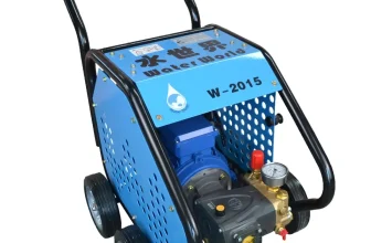
Hydro excavation
Using water pressure
Hydro excavation is an effective and controlled method of locating
underground pipes by utilizing high-pressure water. This technique
involves the use of specialized trucks equipped with water tanks and
pressure systems that produce a powerful, precise stream of water. The
high-pressure water jet loosens the soil and breaks it up, allowing for
easier removal of the surrounding material.
One of the key features that sets hydro excavation apart from
traditional excavation methods is the precision and control it offers.
The water pressure can be adjusted according to the soil composition,
and the excavator nozzle can be configured for a specific width,
reducing the risk of damaging utility lines and surrounding structures.
This also means that less time is spent on backfilling and repair works
after the excavation is completed.
Furthermore, the use of water in hydro excavation ensures a cleaner
and safer work environment, as it helps to minimize dust and airborne
particles. This results in improved visibility and reduced health risks
for workers on-site. In some instances, hydro excavation may also be the
preferred method for locating pipes in various environmental conditions,
such as frozen ground or clay-rich soils, where traditional excavation
methods may prove to be challenging.
However, it is important to note that hydro excavation may not be the
best fit for every situation. In some cases, the use of high-pressure
water can lead to erosion or destabilization of the ground surrounding
the excavation site, especially in areas where the soil is more prone to
water runoff or contains a high water table. Additionally, the
environmental impact of the water used during excavation may also be a
consideration, as some regions may have water usage restrictions or
require the implementation of sediment control measures to prevent
run-off and contamination.
In summary, hydro excavation, through the use of water pressure, is a
reliable and controlled method for finding underground pipes. It offers
a cleaner and safer alternative to traditional excavation techniques
while minimizing the risks associated with damage to utilities and
structures. However, it is crucial to consider the project site’s
specific conditions and any potential environmental concerns when
selecting hydro excavation as the preferred method.
Environmental concerns and
benefits
Hydro excavation, also known as hydrovac, is a popular method of
locating underground pipes, primarily due to its environmental
advantages over other destructive methods such as traditional
excavation. While there are a few environmental concerns associated with
this method, they are generally outweighed by its benefits.
One of the main environmental concerns with hydro excavation is water
consumption. This method utilizes high-pressure water to loosen soil and
debris around underground pipes, which can lead to a significant amount
of water usage. This may be an issue in areas facing water scarcity or
dealing with strict regulations on water consumption. However, it is
worth noting that some specialized hydro excavation equipment can
minimize water usage through features such as recirculating systems, and
operators can also employ techniques that optimize water usage during
the process.
Additionally, hydro excavation produces a large volume of slurry (a
mixture of soil and water) that must be properly managed to avoid
negative impacts on the environment. Companies must adhere to strict
guidelines for safe disposal of the slurry, such as transporting it to
approved disposal sites, and avoiding unauthorized dumping or discharge
into natural bodies of water.
Despite these concerns, hydro excavation offers substantial
environmental benefits. One of the major advantages is the reduced
disruption to the surrounding soil and ecosystem. As the process
precisely targets the area of interest, it leaves a minimal amount of
disturbance to nearby soil structures, root systems, and underground
habitats. This precise nature of hydro excavation also limits the
likelihood of unintended damage to other utility lines, which could
cause fuel leaks or other hazardous situations.
Furthermore, hydro excavation generates less dust, noise, and
vibration compared to traditional digging methods. This reduces air
pollution, preserves the quality of life for local human and wildlife
populations, and minimizes the risk of damage to nearby structures.
Lastly, hydro excavation reduces the need for extensive restoration
work after the completion of the project. As it only removes necessary
soil from the site, there is a significantly smaller area that needs to
be refilled, compacted, and re-landscaped. This can save time, money,
and further environmental impact in the long run.
In conclusion, although there are a few environmental concerns
associated with hydro excavation, its benefits provide a more
sustainable and environmentally friendly solution compared to other
destructive methods. As technology continues to improve, the process
will likely become even more efficient and environmentally conscious,
making it an increasingly attractive option for finding underground
pipes.
Advanced Technologies
Pipe inspection cameras
Visual inspection
Pipe inspection cameras have revolutionized the way we inspect and
identify problems found in underground pipes. These specialized cameras
give construction workers, utility companies, and maintenance
professionals the ability to visually inspect pipes without the need for
disruptive excavation methods. This not only saves time and money but
also minimizes potential damage to infrastructure or utilities.
These specialized cameras are equipped with high-resolution lenses
and powerful lighting systems that allow for clear and detailed imaging
of the pipes’ interiors, even in low-light situations. The cameras are
encased in durable and waterproof housings, allowing them to operate in
challenging environments, including wet and muddy pipes. With their
compact size, they can easily navigate through both large and small
pipes with ease, providing valuable access to areas that might otherwise
be difficult or impossible to inspect.
The pipe inspection cameras are typically mounted on robotic crawlers
or attached to push rods, which can traverse long distances, moving
through turns, bends, and other obstructions inside the pipes.
High-definition video feed is transmitted from the camera in real-time
to a display screen, usually located in a control unit on the ground
surface. This allows the operator to view, record and analyze the
footage while the inspection is taking place, providing an immediate and
accurate assessment of the pipe’s condition.
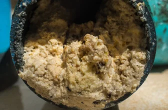
Visual inspection using pipe inspection cameras can help identify a
wide range of potential issues within the pipes, such as corrosion,
cracks, leaks, blockages, and root infiltration. Additionally, these
inspections can also assist in determining the overall health of the
pipe system, highlighting any areas that may require preventative
maintenance or repairs before a larger issue arises. This proactive
approach can help avoid costly emergencies and extend the life of the
pipes.
In conclusion, pipe inspection cameras have become an invaluable tool
for assessing and maintaining underground pipe infrastructure. With
their ability to provide clear, real-time visual inspections in
challenging environments, these cameras allow industry professionals to
efficiently and effectively diagnose, plan, and carry out the essential
maintenance that keeps our modern world running smoothly.
Applications for
diagnosis and planning
Pipe inspection cameras have revolutionized the way we approach the
diagnosis and planning of underground pipe maintenance and repair
projects. These advanced tools provide immediate visual access to the
inner workings of underground pipe systems, helping professionals detect
and evaluate various issues with accuracy and efficiency.
One of the primary applications for pipe inspection cameras is the
detection of leaks, cracks, and blockages in underground pipe systems.
By inserting the camera into the pipe and maneuvering it through the
system, professionals can visually identify problem areas, determine the
severity of the damage, and recommend appropriate corrective measures.
This eliminates the need for guesswork and reduces the risk of expensive
overruns and delays.
Another important application is the evaluation of pipe material and
structural integrity. Over time, pipes can become corroded, leading to
the weakening of the pipe walls, which can ultimately result in leaks or
even pipe collapse. A visual inspection using pipe cameras allows
professionals to assess the condition of the pipe material, ensuring the
necessary maintenance and replacement of degraded sections occur before
the situation becomes critical.
In addition to diagnosing existing issues, pipe inspection cameras
play a vital role in pre-construction and renovation planning. By
providing a clear view of underground pipe systems, these advanced tools
can help engineers create accurate maps and designs, avoiding costly and
time-consuming conflicts with existing infrastructure. Moreover, visual
inspection cameras can also ensure that new installations are completed
according to specifications, checking for proper alignment, slope, and
positioning.
Furthermore, pipe cameras facilitate regular preventative
maintenance, helping to extend the life of underground pipe systems. By
conducting routine video inspections, professionals can identify the
early warning signs of potential issues such as sediment buildup, root
intrusion, or material degradation, thereby enabling proactive
interventions to prevent more severe and costly problems down the
line.
In summary, the applications of pipe inspection cameras in diagnosing
issues, planning projects, and ensuring proper maintenance are
invaluable to the success and longevity of underground pipe systems. The
use of these cutting-edge tools not only improves accuracy and
efficiency but also promotes the responsible use of resources and the
preservation of our built environment.
Utility mapping software
Combining multiple data
sources
Utility mapping software plays a crucial role in accurately locating
underground pipes and streamlining maintenance efforts. By combining
multiple data sources, mapping software provides a comprehensive
overview of the underground infrastructure that aids professionals in
planning, managing, and maintaining buried utilities.
One of the primary benefits of using utility mapping software stems
from the integration of data from various sources such as
ground-penetrating radar (GPR), electromagnetic pipe locators, acoustic
devices, and infrared thermography. This convergence of data allows for
more accurate and efficient identification of underground pipes, even in
areas with a dense and complex network of utilities.
Data collected using different techniques can be compiled in layers
on the software, offering a multidimensional view of the underground
utilities. This approach eliminates the need to reference multiple
separate reports, reducing errors in interpretation and saving time
during planning and maintenance activities. Moreover, these layers can
be updated as new data becomes available, ensuring that the utility map
remains current and accurate.
Another advantage of utility mapping software is its ability to
incorporate geographic information system (GIS) data. GIS data can
include crucial information such as topography, soil type, building
locations, and road networks. When combined with underground utility
data, this information furthers our understanding of the subsurface
environment and enables better decision-making in terms of project
planning and risk management.
Furthermore, utility mapping software often comes with analysis tools
that aid in identifying potential issues or conflicts between different
utility types. For example, the software can highlight areas where two
pipes are close to crossing each other, requiring extra attention during
excavation or repair work.
To sum up, utility mapping software is an invaluable tool in the
efficient location and management of underground pipes. By combining
multiple data sources, these programs can improve the accuracy and
efficiency of utility detection and mapping, helping professionals to
avoid costly mistakes and ensure the safe operation of underground
infrastructure.
Increase in accuracy and
efficiency
Utility mapping software has greatly impacted the way underground
pipes are located, enabling smoother and more efficient processes in
various industries. The integration of this technology can significantly
increase the accuracy and efficiency of underground pipe detection,
making it one of the most effective tools in the modern age.
One contributing factor to the enhanced accuracy is the
interconnectivity of various data sources. Utility mapping software
brings together information from multiple sources such as pipe material,
soil type, GIS data, and excavation records, creating a comprehensive
underground utility map. By consolidating this wealth of data, users can
make more informed decisions and pinpoint the location of underground
pipes with greater precision.
Efficiency is improved by enabling professionals to quickly access
and analyze the data related to underground pipe systems. This software
provides an organized platform that simplifies data retrieval and
analysis while visualizing important details.
As a digital solution, utility mapping software also enables
real-time collaboration and data sharing between members of a team or
different departments involved in a project. This eliminates
communication barriers and ensures that all parties have access to the
most up-to-date information, reducing the likelihood of errors and
miscommunication. As a result, project timelines are often reduced and
fewer resources are wasted, effectively cutting costs.
Another aspect that enhances efficiency is the ability to perform
virtual simulations of excavation projects, allowing professionals to
plan and prepare for unexpected challenges that might arise during the
actual digging process. This eliminates the need for guesswork, reducing
the chances of causing damage to existing underground utilities.
In conclusion, utility mapping software is a crucial advancement in
the field of underground pipe detection. By increasing accuracy through
the consolidation of data sources and improving efficiency through
enhanced collaboration and planning capabilities, it is a powerful tool
that has transformed the way professionals locate infrastructure hidden
beneath the surface.
3D mapping technologies
Integration with GIS systems
3D mapping technologies have emerged as a powerful tool in the
process of locating underground pipes. These technologies are
revolutionizing the way professionals map, identify, and manage
underground utilities, especially when combined with geographic
information systems (GIS). Integrating 3D mapping technologies with GIS
enables users to create more accurate, efficient, and comprehensive
underground utility maps.
GIS systems are widely used in the infrastructure industry to store,
manipulate, and visualize spatial data. By incorporating 3D mapping data
into GIS platforms, utility companies and service providers can better
understand the complex subsurface environment. This integration allows
professionals to view, analyze, and interpret underground utility data
within a geospatial context, significantly improving decision-making
processes and project planning.
One major benefit of incorporating 3D mapping technology within GIS
systems is the ability to generate realistic visualizations of
underground assets. These visualizations offer a clear perspective on
the depth, size, material, and condition of buried pipes, enabling
professionals to identify potential issues and plan necessary
maintenance or repairs with greater precision.
Another advantage of integrating 3D mapping technologies with GIS
systems is the ability to use the geospatial data to construct
comprehensive 3D models of the underground environment. These models can
be easily shared among different departments, improving communication
and collaboration among project teams.
The integration of 3D mapping technologies and GIS systems also
contributes to the creation of smart city platforms. As urban centers
continue to grow and evolve, the need for efficient management of
underground assets becomes increasingly important. By harnessing the
power of 3D mapping and GIS integration, operators can optimize resource
allocation, minimize downtime, and reduce operational costs.
Moreover, 3D mapping technologies and GIS integration play a crucial
role in mitigating risks associated with ground disturbances. By
providing a comprehensive understanding of the subsurface environment,
professionals can ensure the safety of construction workers and avoid
costly damages to underground utilities during excavation projects.
In summary, the integration of 3D mapping technologies with GIS
systems offers numerous advantages for locating and managing underground
pipes. This innovative approach leads to improved accuracy, enhanced
communication, and ultimately, higher efficiency in the infrastructure
industry. As advances in technology continue, it is crucial that
professionals adapt to these changes and incorporate the latest 3D
mapping and GIS solutions into their daily operations.
Benefits for planning and
maintenance
The implementation of 3D mapping technologies in the process of
locating underground pipes offers numerous benefits, particularly in the
areas of planning and maintenance. With the ability to create visually
detailed, three-dimensional representations of underground utilities,
these technologies enhance the accuracy and efficiency of both current
construction projects and future maintenance efforts.
One of the primary advantages of 3D mapping technologies is the
ability to identify the precise position of underground utilities,
reducing the likelihood of accidental damage during construction or
repair projects. By knowing the exact location, depth, and orientation
of existing pipes and other utilities, engineers and construction crews
can effectively plan their works to avoid these areas, minimizing the
risk of costly damages and project delays.
Additionally, 3D mapping enables more streamlined maintenance through
the visualization of the entire underground infrastructure. Maintenance
teams can easily detect and analyze possible issues such as potential
pipe collapses or leaking points, allowing for early, targeted
intervention. By identifying any changes or irregularities in the ground
or surrounding environment, teams can proactively address risks before
they lead to severe infrastructure damage, thereby reducing the overall
maintenance costs.
Furthermore, 3D mapping technologies enhance communication and
collaboration among different stakeholders in utility projects, such as
engineers, construction teams, and utility companies. The ability to
produce accurate and interactive digital maps enables these parties to
share and integrate vital information into their work processes,
resulting in more efficient and well-informed decision-making.
Lastly, the integration of 3D mapping with other advanced
technologies, such as geographic information systems (GIS) and building
information modeling (BIM), aids in the development of sustainable
infrastructure solutions. By combining various datasets from geospatial
and modeling technologies, stakeholders can better understand the
interrelation of utilities within the project area and develop optimized
designs that minimize environmental impact and promote long-term
resiliency.
In summary, the incorporation of 3D mapping technologies in the
pursuit of locating underground pipes contributes to significant
improvements in planning and maintenance efforts. Through increased
accuracy, risk minimization, enhanced communication, and the promotion
of sustainable infrastructure development, these advanced methods have
the potential to revolutionize the way underground utility projects are
managed in the future.
Professional Services and
Training
Hiring utility locating
companies
Hiring utility locating companies is a wise investment for those
seeking to identify and map underground pipes. With their specialized
knowledge and access to advanced equipment, these companies play a
crucial role in ensuring accuracy and safety during various construction
and maintenance projects.
Utility locating companies possess the expertise to navigate the
complexities of detecting and mapping underground utilities. Their
professional teams are trained in using various tools and methods
described in this article, including ground penetrating radar,
electromagnetic locators, and acoustic devices, among others. Their
experience in handling a wide range of projects allows them to
seamlessly adapt to different situations, materials, and site
conditions, making them indispensable in locating and identifying
underground pipes.
Furthermore, utility locating companies have access to specialized
and often expensive equipment that may be otherwise difficult for
individuals or organizations to acquire or operate. This equipment –
such as high-resolution ground penetrating radar systems, advanced pipe
inspection cameras, and 3D mapping technologies – ensures more accurate
and reliable results during the pipe locating process. By employing
these specialized tools, utility locating companies can reduce the
margin of error and the risks associated with damaging underground
utilities.
Hiring utility locating companies also saves time and resources for
project managers, as these professionals can quickly and efficiently
identify the position of underground pipes, allowing for smoother
project execution. Moreover, the quality of service provided by these
experts often decreases the chances of costly mistakes, such as damaging
critical infrastructure, which could lead to project delays or even
legal liabilities.
In summary, hiring utility locating companies is a valuable decision
when seeking to identify and map underground pipes. Their expertise and
access to cutting-edge technology increases accuracy and safety while
also saving time and resources. Owners and project managers are strongly
encouraged to consider these professional services as an essential
component of their project planning and execution processes.
Ensuring accuracy and safety
Hiring utility locating companies to find underground pipes is a
smart decision that ensures accuracy and safety. These companies have
the expertise and specialized equipment necessary to accurately locate
and identify buried utilities, minimizing the risk of damage during
excavation projects.
One of the benefits of working with a professional utility locating
company is that their staff have been trained in the proper use of a
variety of locating tools and methods. This expertise allows them to
select the appropriate technology for the specific project, increasing
the accuracy of their findings. Moreover, professionals are continually
updating their knowledge and skills to stay current with advances in the
industry, ensuring that their methods remain effective and reliable.
Safety is a paramount concern when dealing with underground
utilities. The consequences of damaging a gas or electric line can be
disastrous and even life-threatening. Professional utility locating
companies are well-versed in following safety procedures and best
practices to prevent such incidents. They are also familiar with the
necessary permits and regulations governing underground utility work,
further mitigating risks associated with these projects.
Hiring a utility locating company adds an extra layer of protection
for both the client and the environment. By precisely pinpointing the
location of utilities, they minimize the need for untargeted digging and
excavation, reducing the risk of environmental damage caused by
excessive soil disturbance or accidental damage to existing
utilities.
In conclusion, engaging the services of a professional utility
locating company plays a significant role in ensuring accuracy and
safety. Their expertise and adherence to industry standards make certain
that utilities are located and identified correctly, paving the way for
safe and efficient construction, maintenance, and repair projects.
Training and certification
Importance of proper
training
Proper training in underground pipe detection plays a crucial role in
ensuring the accuracy, safety, and efficiency of locating and
maintaining underground utilities. As the tools and methods used for
pipe detection become more advanced and sophisticated, skilled
professionals who are well-versed with these technologies become
indispensable in preventing potentially dangerous accidents and costly
mistakes.
One of the primary reasons obtaining proper training is vital lies in
the fact that mislocating or damaging underground pipes can result in
severe consequences such as gas leaks, water contamination, and power
outages. Furthermore, these accidents can disrupt essential services for
communities and may even endanger lives. Workers with appropriate
training and knowledge can minimize these risks by accurately locating
utilities and following safe practices during excavation or maintenance
procedures.
Proper training also contributes to increased efficiency in locating
underground pipes. Trained professionals are able to utilize various
tools and methods to their full potential and determine the most
appropriate techniques to employ based on the specific situation. This
optimization results in time and cost savings, while also reducing
environmental impact and minimizing disruptions to nearby
infrastructure.
Additionally, well-trained professionals are essential for keeping up
with the rapid advancements in underground pipe locating technology. As
new developments emerge, experts stay abreast of these innovative tools
and methods. Continual learning ensures that professionals are always
employing the most up-to-date and effective practices, contributing to
higher accuracy and quality standards in the field.
In summary, proper training is of paramount importance for
underground pipe locating professionals. It ensures a high degree of
competency and expertise, which directly contribute to the accuracy,
safety, and efficiency of the locating process. As technology continues
to advance, well-trained professionals will continue to be essential in
maintaining and improving public utilities’ service quality and
minimizing risks associated with buried pipe networks.
Available certifications
and courses
A variety of certifications and courses are available for individuals
who want to develop professional skills in underground pipe locating.
These training programs help ensure that professionals are well-equipped
with the knowledge and techniques required for accurate and safe pipe
detection. Some of the notable certifications and courses include the
following:
- Utility Locating Training and Certification Program (UCTA): This
program is designed to provide comprehensive and hands-on training in
utility locating. Participants gain in-depth knowledge on the use of
non-destructive equipment and techniques, such as ground-penetrating
radar, electromagnetic pipe locators, and infrared thermography, to
accurately locate underground utilities. Upon successful completion of
the course, individuals earn a UCTA Certified Utility Locator
certificate. - National Utility Locating Contractors Association (NULCA)
Certification: NULCA offers an extensive training program aimed at
enhancing the skills of utility locating professionals. The program
covers topics such as locating fundamentals, field techniques, damage
prevention, and utility owner relations. To achieve this certification,
candidates must pass an exam administered by NULCA. - Common Ground Alliance (CGA) Locator Training: The CGA offers a
locator training program that teaches essential techniques and best
practices for finding underground pipes. The training includes modules
on damage prevention, utility owner relations, and state-specific
regulations related to excavating near underground utilities. Further,
CGA courses often meet One Call ticket-response requirements in certain
states. - Underground Utilities and Excavation Safety Training: This course
is available through OSHA Outreach Training Centers and focuses on the
safe practices of excavation and utility locating. The course emphasizes
OSHA standards and teaches participants how to comply with electrical,
gas, and water utility regulations during excavation projects. - Online Training Courses: Many organizations offer online utility
locating courses that individuals can complete at their own pace. These
courses typically focus on specific techniques or equipment, such as
ground-penetrating radar or electromagnetic pipe locators. With the
advantage of flexibility in scheduling and location, online courses are
a convenient option for professionals looking to improve their skills in
underground pipe detection.
The availability of various certifications and courses demonstrates
the importance of proper training in underground pipe locating. These
programs not only help professionals deliver accurate results but also
ensure they can contribute to protecting vital infrastructure and
maintaining public safety.
Conclusion
Summary of tools and methods
In conclusion, a variety of tools and methods are available for
finding underground pipes, ranging from non-destructive techniques such
as ground penetrating radar and electromagnetic pipe locators, to more
invasive methods like excavation and hydro excavation. Advanced
technologies, including pipe inspection cameras, utility mapping
software, and 3D mapping technologies, also play a crucial role in
effectively locating and assessing underground utilities.
The effectiveness and accuracy of these approaches can be further
ensured by engaging professional services and providing proper training
and certification for personnel involved in utility locating tasks.
Continual advancements in these tools and methods are essential for
supporting safe and efficient construction, maintenance, and repair of
underground utilities.
Importance of
continual advancements and training
In the rapidly evolving world of underground utility detection, it
cannot be overstated how crucial it is to embrace continual advancements
and invest in proper training. The diverse range of tools and methods
available today ensures that locating underground pipes is considerably
more efficient and accurate than ever before. The use of non-destructive
methods, such as ground-penetrating radar, electromagnetic locators, and
acoustic devices, allows technicians to find pipes with minimal
disruption to the environment while keeping costs in check.
Despite the progress in technology, there remains ample room for
improvement in the field of underground pipe detection. Researchers and
practitioners need to keep pace with the latest advancements to enhance
the capabilities of existing tools and develop innovative techniques.
The widespread implementation of advanced technologies, such as pipe
inspection cameras, utility mapping software, and 3D mapping
technologies, demonstrates the commitment of the industry to seek better
solutions and provide safer and more efficient services.
Training and certification for professionals in the utility detection
field are of paramount importance. Knowledge of cutting-edge technology
and best practices significantly reduces the risk of damaging the
underground infrastructure, causing costly repairs, service disruptions,
and potential safety hazards. By participating in certification programs
and courses, professionals demonstrate their commitment to understanding
the nuances of underground pipe detection and adopting responsible
working practices.
In conclusion, the technological advancements and continuous training
in underground pipe detection are vital to preserving the integrity of
buried utilities and ensuring the safety of workers and communities. As
new technologies and techniques emerge, it is the responsibility of
professionals and companies in the industry to stay up-to-date with
these developments to continue providing accurate and efficient services
in the future.